Log in
All resources
Create a design
237 Free Artworks of 1617 Maps
travel
city
cartography
geography
cologne
engraving
ciudad
viajes
colonia
plano
jodocus hondius ii, nova totius terrarum orbis geographica ac hydrographica tabula, 1636
eran laor cartographic collection
jodocus hondius ii, nova totius terrarum orbis geographica ac hydrographica tabula, 1636
eran laor cartographic collection
jodocus hondius ii, nova totius terrarum orbis geographica ac hydrographica tabula, 1636
eran laor cartographic collection
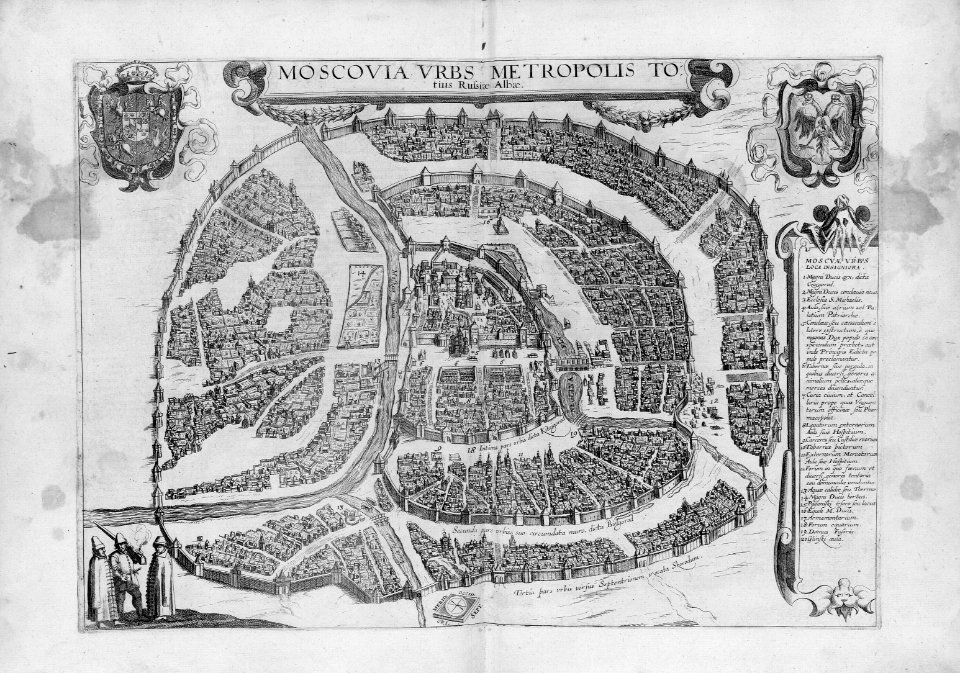
maps of esztergom by braun & hogenberg
štúrovo
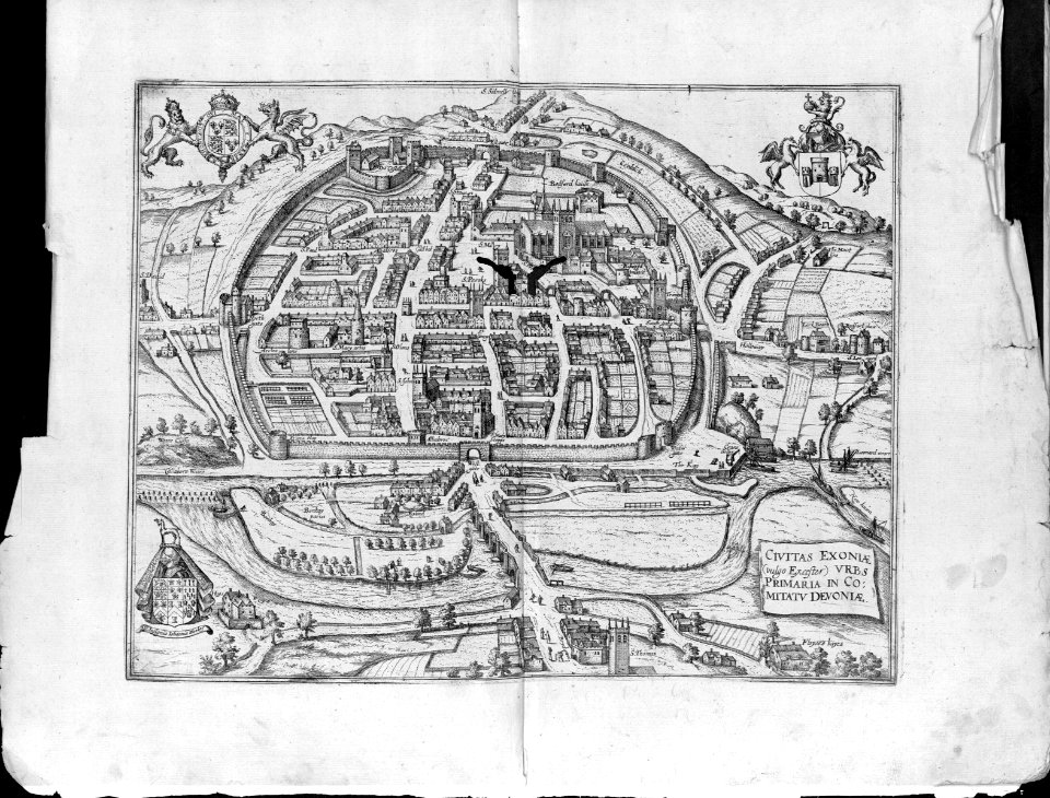
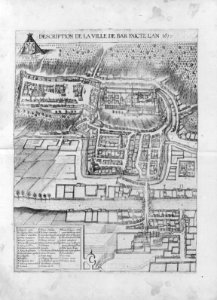
maps of bar-le-duc by braun & hogenberg
bibliothèque nationale de france
colonial history of the united states
old maps of new york (state)
jodocus hondius ii, nova totius terrarum orbis geographica ac hydrographica tabula, 1636
eran laor cartographic collection
etchings in the rijksmuseum amsterdam
1610s maps of belgium
dutch 17th-century prints in the rijksmuseum amsterdam
siege of groenlo 1627
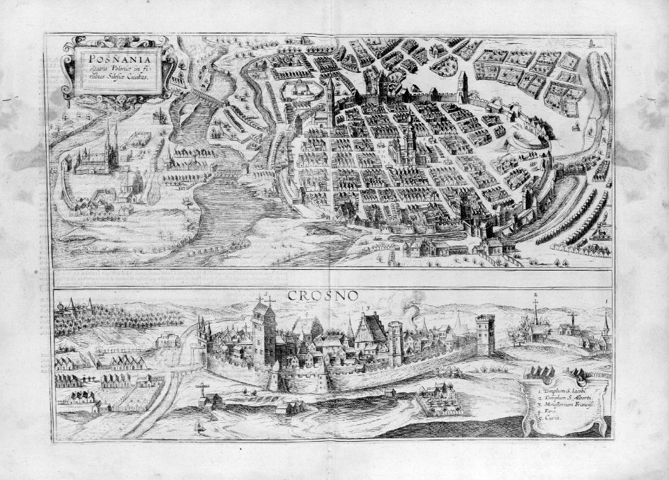
maps of kraków by joris hoefnagel
prints by jacob hoefnagel
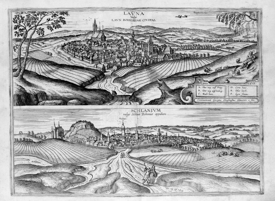
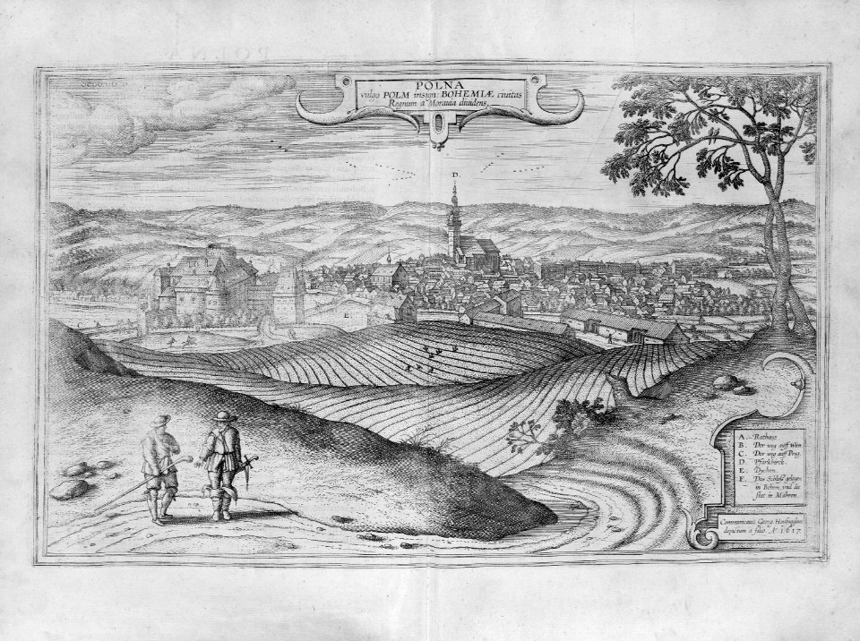
maps of polná by braun & hogenberg
bibliothèque nationale de france
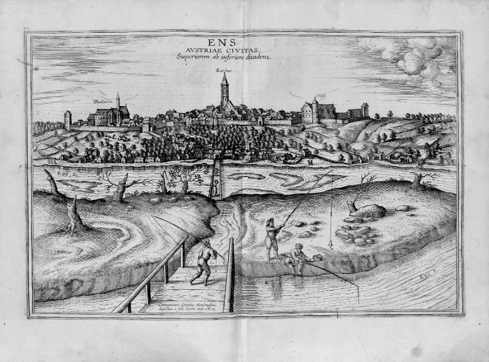
maps of enns by braun & hogenberg
bibliothèque nationale de france
engravings in the rijksmuseum amsterdam
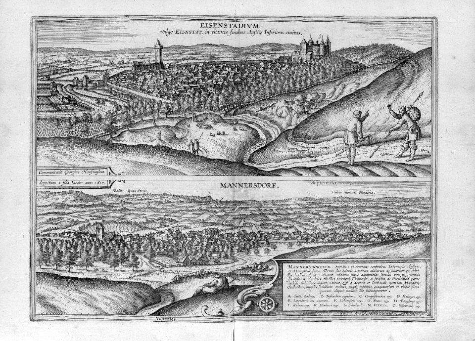
maps of eisenstadt by braun & hogenberg
dutch 17th-century prints in the rijksmuseum amsterdam
capture of brielle
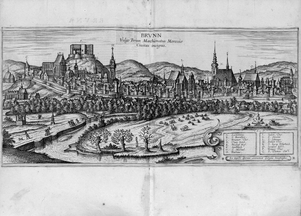
maps of brno by braun & hogenberg
bibliothèque nationale de france
travel
maps
travel
maps
travel
maps
travel
maps
travel
maps
travel
maps
travel
maps
travel
maps
travel
maps
travel
maps
travel
maps
travel
maps
travel
maps
travel
maps
travel
maps
travel
maps
travel
maps
travel
maps
travel
maps
travel
maps
travel
maps
travel
maps
travel
maps
travel
maps
travel
maps
travel
maps
travel
maps
travel
maps
travel
maps
travel
maps
travel
maps
travel
maps
travel
maps
travel
maps
travel
maps
travel
maps
travel
maps
travel
maps
travel
maps
travel
maps
travel
maps
maps of granada by braun & hogenberg
people in granada in art
travel
maps
travel
maps
17th-century prints in the rijksmuseum amsterdam
maps of polná by braun & hogenberg
engravings in the rijksmuseum amsterdam
maps of eisenstadt by braun & hogenberg
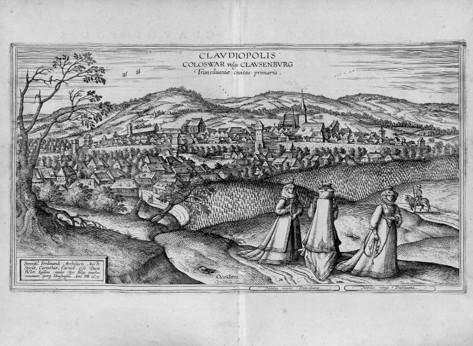
maps of cluj-napoca by braun & hogenberg
bibliothèque nationale de france
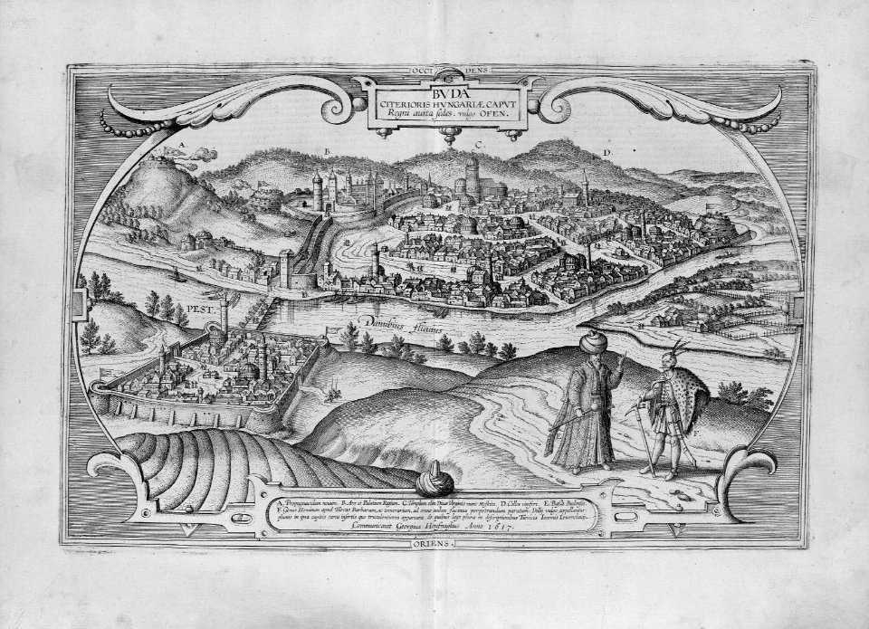
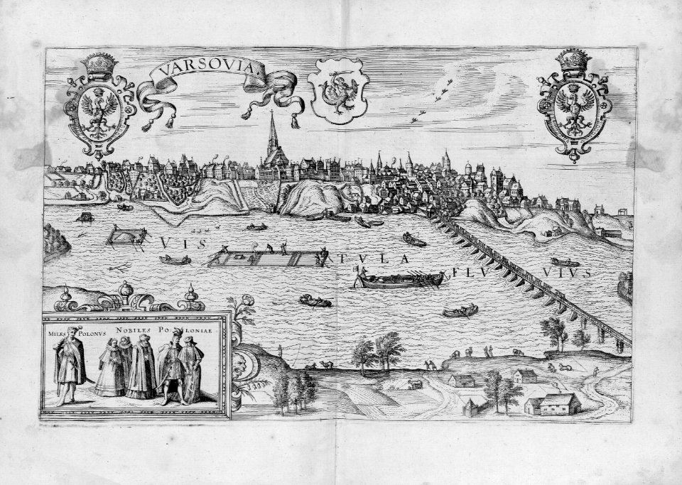
maps of budapest by joris hoefnagel
men of turkey in art
maps of drégelypalánk by braun & hogenberg
bibliothèque nationale de france
maps of eger by braun & hogenberg
bibliothèque nationale de france
colored copperplate engraving
asia noviter delineata
maps of veľký šariš by braun & hogenberg
bibliothèque nationale de france
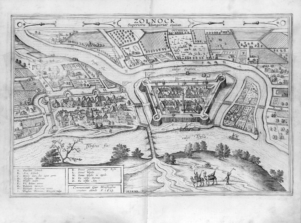
maps of szolnok by braun & hogenberg
bibliothèque nationale de france
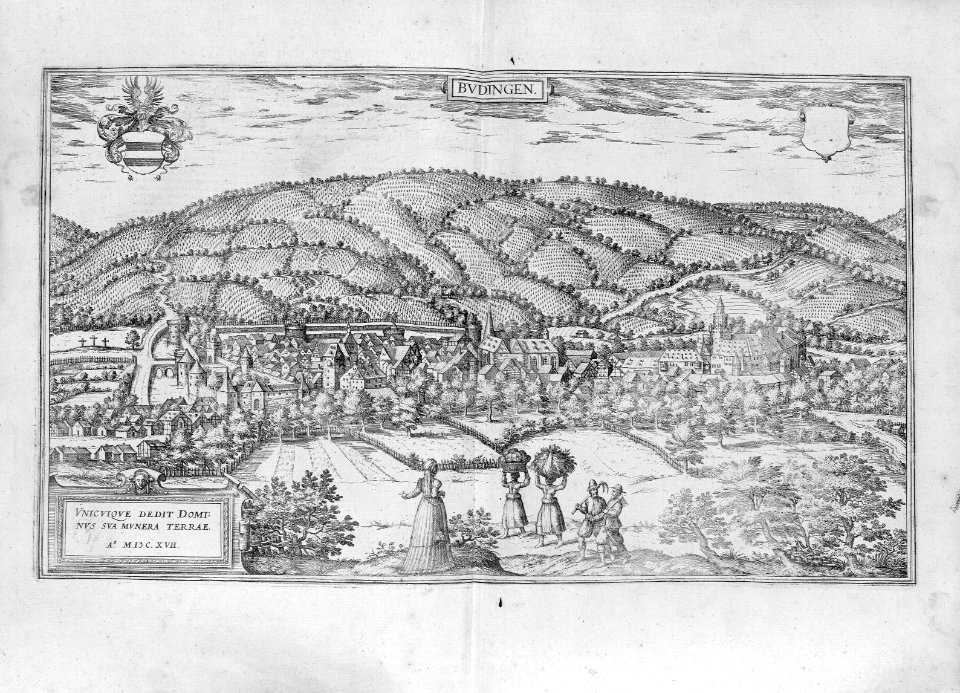
maps of büdingen by braun & hogenberg
bibliothèque nationale de france
la germanie inférieure de petrus keerius - c'est à dire- nouvelles et exactes cartes géographiques des xvii provinces dicelle
maps in the library of congress
la germanie inférieure de petrus keerius - c'est à dire- nouvelles et exactes cartes géographiques des xvii provinces dicelle
maps in the library of congress
la germanie inférieure de petrus keerius - c'est à dire- nouvelles et exactes cartes géographiques des xvii provinces dicelle
maps in the library of congress
la germanie inférieure de petrus keerius - c'est à dire- nouvelles et exactes cartes géographiques des xvii provinces dicelle
maps in the library of congress
la germanie inférieure de petrus keerius - c'est à dire- nouvelles et exactes cartes géographiques des xvii provinces dicelle
maps in the library of congress
la germanie inférieure de petrus keerius - c'est à dire- nouvelles et exactes cartes géographiques des xvii provinces dicelle
maps in the library of congress
la germanie inférieure de petrus keerius - c'est à dire- nouvelles et exactes cartes géographiques des xvii provinces dicelle
maps in the library of congress
la germanie inférieure de petrus keerius - c'est à dire- nouvelles et exactes cartes géographiques des xvii provinces dicelle
maps in the library of congress
la germanie inférieure de petrus keerius - c'est à dire- nouvelles et exactes cartes géographiques des xvii provinces dicelle
maps in the library of congress
la germanie inférieure de petrus keerius - c'est à dire- nouvelles et exactes cartes géographiques des xvii provinces dicelle
maps in the library of congress
la germanie inférieure de petrus keerius - c'est à dire- nouvelles et exactes cartes géographiques des xvii provinces dicelle
maps in the library of congress
la germanie inférieure de petrus keerius - c'est à dire- nouvelles et exactes cartes géographiques des xvii provinces dicelle
maps in the library of congress
la germanie inférieure de petrus keerius - c'est à dire- nouvelles et exactes cartes géographiques des xvii provinces dicelle
maps in the library of congress
la germanie inférieure de petrus keerius - c'est à dire- nouvelles et exactes cartes géographiques des xvii provinces dicelle
maps in the library of congress
la germanie inférieure de petrus keerius - c'est à dire- nouvelles et exactes cartes géographiques des xvii provinces dicelle
maps in the library of congress
la germanie inférieure de petrus keerius - c'est à dire- nouvelles et exactes cartes géographiques des xvii provinces dicelle
maps in the library of congress
la germanie inférieure de petrus keerius - c'est à dire- nouvelles et exactes cartes géographiques des xvii provinces dicelle
maps in the library of congress
la germanie inférieure de petrus keerius - c'est à dire- nouvelles et exactes cartes géographiques des xvii provinces dicelle
maps in the library of congress
la germanie inférieure de petrus keerius - c'est à dire- nouvelles et exactes cartes géographiques des xvii provinces dicelle
maps in the library of congress
la germanie inférieure de petrus keerius - c'est à dire- nouvelles et exactes cartes géographiques des xvii provinces dicelle
maps in the library of congress
la germanie inférieure de petrus keerius - c'est à dire- nouvelles et exactes cartes géographiques des xvii provinces dicelle
maps in the library of congress
la germanie inférieure de petrus keerius - c'est à dire- nouvelles et exactes cartes géographiques des xvii provinces dicelle
maps in the library of congress
la germanie inférieure de petrus keerius - c'est à dire- nouvelles et exactes cartes géographiques des xvii provinces dicelle
maps in the library of congress
la germanie inférieure de petrus keerius - c'est à dire- nouvelles et exactes cartes géographiques des xvii provinces dicelle
maps in the library of congress
la germanie inférieure de petrus keerius - c'est à dire- nouvelles et exactes cartes géographiques des xvii provinces dicelle
maps in the library of congress
la germanie inférieure de petrus keerius - c'est à dire- nouvelles et exactes cartes géographiques des xvii provinces dicelle
maps in the library of congress
la germanie inférieure de petrus keerius - c'est à dire- nouvelles et exactes cartes géographiques des xvii provinces dicelle
maps in the library of congress
la germanie inférieure de petrus keerius - c'est à dire- nouvelles et exactes cartes géographiques des xvii provinces dicelle
maps in the library of congress
la germanie inférieure de petrus keerius - c'est à dire- nouvelles et exactes cartes géographiques des xvii provinces dicelle
maps in the library of congress
la germanie inférieure de petrus keerius - c'est à dire- nouvelles et exactes cartes géographiques des xvii provinces dicelle
maps in the library of congress
la germanie inférieure de petrus keerius - c'est à dire- nouvelles et exactes cartes géographiques des xvii provinces dicelle
maps in the library of congress
101 - 200 of 237
Next page
/ 3


![Polna vulgo Polm insign. Bohemiae civitas regnum a Moravia dividens / Communicavit Georg[ius] Houfnaglius depictum a filio A[nn]o 1617, 1635](https://cdn.creazilla.com/illustrations/10001289479/polna-vulgo-polm-insign-bohemiae-civitas-regnum-a-moravia-dividens-communicavit-georgius-houfnaglius-depictum-a-filio-anno-1617-1635-md.jpg)


![Palanka Superioris Hungariae civitas / Communicavit Georgius Houfnaglius acceptum aliunde A[nn]o 1617, 1635](https://cdn.creazilla.com/illustrations/10000654601/palanka-superioris-hungariae-civitas-communicavit-georgius-houfnaglius-acceptum-aliunde-anno-1617-1635-md.jpg)
![Agria vulgo Erla / Communicavit Georgius Houfnaglius acceptum ab alio A[nn]o 1617, 1635](https://cdn.creazilla.com/illustrations/10000708457/agria-vulgo-erla-communicavit-georgius-houfnaglius-acceptum-ab-alio-anno-1617-1635-md.jpg)

![Zaros Superioris Hungariae civitas et propugnaculum / Communicavit Georgius Houfnaglius A[nn]o 1617, 1635](https://cdn.creazilla.com/illustrations/10000261266/zaros-superioris-hungariae-civitas-et-propugnaculum-communicavit-georgius-houfnaglius-anno-1617-1635-md.jpg)
![Zolnock Superioris Hungariae civitas / Communicavit Geor[gius] Houfnaglius acceptum aliunde A[nn]o 1617, 1635](https://cdn.creazilla.com/illustrations/10000919760/zolnock-superioris-hungariae-civitas-communicavit-georgius-houfnaglius-acceptum-aliunde-anno-1617-1635-md.jpg)


